


Planit Pro: Photo Planner
4.6175.00 Reviews
App Specs
- Version
- 11.0.17
- Updated On
- License
- $9.99
- Downloads
- 10,000+
- Developer
- JIDE Software
- Categories
- Photography
- Platform
- Android, iOS
Screenshots
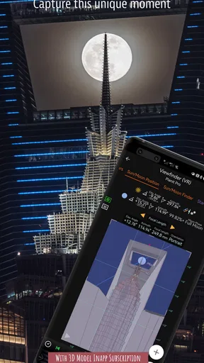
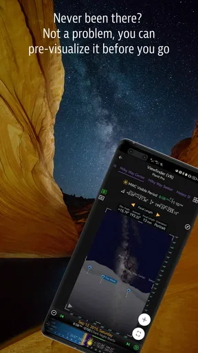
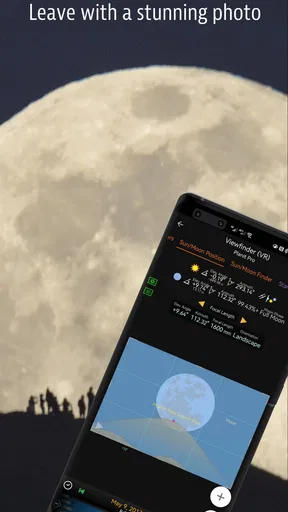
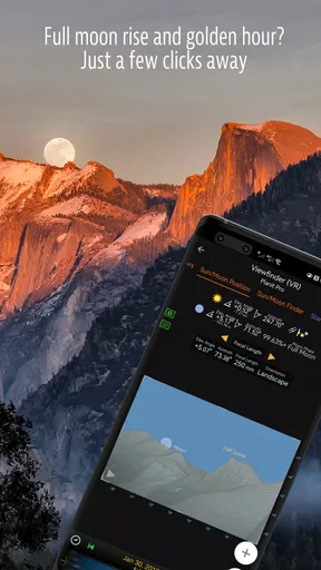
 Analysis by AppCompare
I use a lot of photography apps that promise to make outdoor shooting easier, but Planit Pro: Photo Planner takes a more deliberate approach. Instead of helping mainly after I have taken a picture, it is designed around planning the picture before I arrive. That difference matters most when the scene depends on timing, direction, viewpoint, and the relationship between the landscape and the sky.
Developed by JIDE Software, this Photography app is aimed especially at people who enjoy landscapes and want more control over a shoot. Its store summary calls it a must-have for landscape photographers, and after spending time with it, I understand why that description appeals to a very specific audience. This is not the kind of camera app I would open for a quick snapshot in the street. It is closer to a preparation tool for a planned outing, where a little work beforehand can prevent a disappointing trip.
The app has a 4.6 average from around 1.2 thousand ratings, with over a thousand installs represented by its 10K+ listing. It is rated Everyone, runs on Android 7.0 or later, and the current version is 11.0.17. The price is $9.99, while optional purchases range from $0.99 to $99.99 per item. Those details immediately place it in a different category from casual free photo utilities: it asks for a meaningful commitment, so the value depends on whether planning is genuinely part of your photography routine.
Planning the scene before the camera comes out
I approach this section as a look at the decisions that happen before a landscape outing, when I’m still weighing whether a promising alignment is practical. I find it useful to separate what the map can help me reason through from what I must check on the ground, especially when a plan depends on a narrow viewing angle. That distinction sets up a closer look at where the tool earns its place.
The central capability is visual preparation
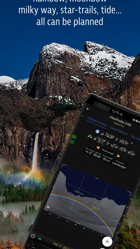
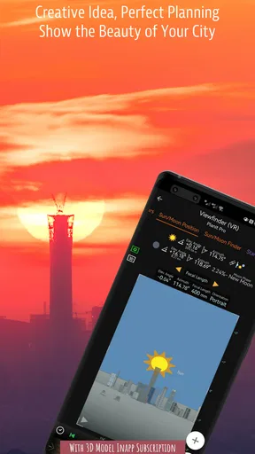
The most important thing about Planit Pro: Photo Planner is its focus on visualizing a future photograph. Rather than simply telling me that a sunrise or sunset is coming, the app encourages me to think about where the light, sun, moon, landscape, and viewpoint will line up. That turns a vague idea such as “I want the sun behind that peak” into a location and timing problem that I can investigate before packing my camera.
That sounds simple, but it changes the way I approach landscape photography. With ordinary weather or calendar apps, I can check conditions and times, yet I still have to imagine the composition in my head. With a standard map, I can find a trail or viewpoint, but the map does not naturally answer whether the key subject will sit in the right part of the frame. This planner brings those decisions closer together, which is its strongest reason to exist.
I found the approach most useful when the subject was fixed but the light was not. A mountain, monument, coastline, or building can remain in the same place for years, while the sun and moon shift across the horizon. The app helps me treat the scene as something that can be revisited under different conditions instead of something I simply hope will look good when I arrive.
Worth Reading Before You Choose

Flipboard Shows What News Apps Must Do Beyond the Feed

Switching to Android Auto Means Rethinking Your Driving Routine

Google Calendar Makes a Crowded Week Easier to Manage

Ludo King Makes the Most of the Minutes Between Plans

Baby Panda World Brings Quick Play to Modern Phones, but Its Game Library Feels Busy

ESPN’s Live Game View Makes Following Close Games Easier
The real benefit is fewer blind trips, not more buttons. If I already know the exact viewpoint, the light direction, and the best time to be there, the app may feel unnecessary. If I am exploring unfamiliar places or chasing a particular alignment, however, the planning stage becomes much more practical.
Why this is different from the usual alternatives
A normal map application is excellent for roads, walking routes, and finding a general destination. It is not built around photographic composition. A weather application can tell me whether clouds or rain are likely, but it does not replace the question of where the light will meet the subject. A camera app may offer manual controls, yet those controls only help once I am already on location.
Planit Pro sits before all of those tools in the workflow. I can use a map to reach a place, a weather service to judge conditions, and a camera app to capture the final image, but this planner addresses the missing middle step: deciding whether the scene is worth the trip at a particular time and from a particular viewpoint.
That also explains why I would not recommend it to everyone who takes photos. Someone who mainly photographs family events, food, pets, or spontaneous city scenes will not get the same return. The app’s value grows when the subject is stationary, the timing matters, and the cost of arriving at the wrong moment is high.
How I would set up a real shoot
My preferred workflow begins with the subject rather than the date. I first think about the photograph I want: perhaps a ridge with warm side light, a full moon near a landmark, or a long view where the direction of the sun changes the entire mood. Then I use the planner to consider possible viewpoints and the direction from which the important light needs to arrive.
After that, I compare several possible dates or times instead of accepting the first promising result. This is one of the less obvious advantages of a planning-first tool. The best composition may not happen on the day that is most convenient. A small change in timing can move the light away from the edge of a subject or place it behind an obstruction, so checking alternatives is more useful than treating one forecast as a final answer.
I also separate composition from conditions. The app can help me decide whether the geometry of the scene makes sense, but it cannot make clouds appear, guarantee clear air, or ensure that a trail will be accessible. I use the planner to establish whether the alignment is possible, then use current practical information to decide whether the outing is sensible.
That distinction prevents a common mistake: confusing a technically perfect alignment with a guaranteed photograph. A well-planned sun position can still produce flat light, haze, crowds, or an obstructed viewpoint. The app improves the odds, but it does not remove the need for judgment in the field.
A useful workflow for uncertain locations
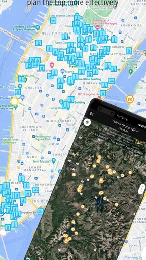
One of my favorite ways to use a tool like this is before visiting a place for the first time. When I only have a rough idea of the landscape, planning helps me narrow the search. Instead of walking around hoping to discover a composition, I can arrive with several possible viewpoints in mind and remain flexible if the first option is inaccessible.
This is particularly helpful for short trips. If I have only one morning near a landmark, guessing can waste the entire opportunity. A planning session beforehand lets me decide whether an early start is justified, whether a different side of the subject is more promising, and whether the desired light is even pointing in the right direction.
There is a trade-off here: the more ambitious the photograph, the more time I need to spend preparing. That is not a flaw unique to the app, but the app makes the preparation visible. I have to think about the scene instead of relying on luck, and photographers who prefer discovery may find that process too analytical.
Where the app earns its place
For me, the app earns its place when planning can save a wasted journey, but that value changes with how and where I use it. A phone is handy for checking an idea while travelling, yet a small screen can make careful map work less comfortable than reviewing a plan at home. I’d weigh those contexts alongside the reliability of the connection before making the app part of a time-sensitive shoot.
The best scenario is a planned landscape outing
The strongest scenario is a landscape shoot where I care about a particular relationship between a foreground subject and a celestial light source. Imagine planning a visit to a viewpoint that is several hours away. The image depends on the sun appearing behind a distant peak, or the moon sitting close to a recognizable structure. Arriving at the wrong time would not merely produce a different mood; it could make the intended composition impossible.
In that situation, the app helps me decide whether the trip deserves the effort. I can work backward from the desired image, choose a likely viewpoint, and investigate when the scene might line up. That is much more useful than checking a generic sunrise time and assuming the rest will take care of itself.
Another realistic example is a photographer planning a weekend around a single landmark. The photographer may have limited time, unfamiliar roads, and equipment that is not easy to carry. A planning tool can reduce unnecessary scouting and make the schedule more intentional. It does not guarantee success, but it can prevent the particularly frustrating error of arriving at a beautiful location when the key light is facing the wrong way.
I also see value for photographers who return to the same local scenes. A familiar overlook may look ordinary most of the year, then become interesting when the sun or moon reaches a specific position. Instead of waiting for a lucky coincidence, I can use the planner to identify opportunities and decide which ones are worth watching.
How to avoid overplanning the photograph
There is a danger in becoming so focused on alignment that the photograph turns into a checklist. I try to use the app to create possibilities, not to dictate the entire shoot. If the light arrives from a slightly different direction, I would rather adapt than ignore a good scene because it does not match the original idea perfectly.
This is where experience still matters. A planner can help with the broad geometry, but composition also depends on foreground distractions, atmospheric depth, texture, contrast, and the way the light actually feels on the day. I treat its result as a reason to explore, not as proof that the final image will work.
A practical tip is to prepare a backup composition for every ambitious alignment. If the main subject is hidden by cloud or the viewpoint proves inaccessible, I can still photograph the surrounding landscape rather than considering the trip a failure. The app is most effective when it improves flexibility instead of encouraging a single all-or-nothing shot.
Where the price becomes easier to justify
At $9.99, this is not an impulse purchase for someone who only occasionally takes landscape photos. I would justify it when a missed opportunity costs more than the app: a long drive, a difficult hike, a limited travel window, or a scene that will not be revisited soon. In those cases, planning can be worth paying for because it supports decisions before time and energy are spent.
The optional purchases, priced from $0.99 to $99.99 per item, also deserve attention before buying. I would approach them carefully and decide whether the core planning workflow already meets my needs. A user who wants a straightforward way to investigate landscape alignments should first judge the app on that central purpose rather than assuming every extra option is necessary.
The cost is harder to defend for casual users who can get enough information from a free map, a basic sun-position tool, and personal observation. Those alternatives require more manual comparison, but they may be perfectly adequate for simple sunrise outings or nearby locations.
The friction I noticed in the planning process
The biggest limitation is not that the app lacks ambition; it is that detailed planning can feel like work. I need to define what I am looking for, understand the terrain, consider access, and interpret the result. New photographers may initially expect a simple answer such as “go here at this time,” but serious landscape photography rarely works that neatly.
There is also a mental gap between a planned position and the real viewpoint. A map can suggest that a composition is possible, while trees, buildings, cliffs, fences, private land, or a closed path interfere in practice. I would never use the app as a substitute for checking access and safety. It is a composition aid, not permission to enter a location or a replacement for local knowledge.
Another trade-off is that planning can make me less spontaneous. If I spend too much time chasing one alignment, I may overlook a better image that appears beside the trail. For that reason, I prefer to set a clear planning limit, save the main idea, and then leave room for improvisation once I am outside.
These limitations are important because they define the right expectations. The application can make the “when and where” of a landscape photograph more understandable, but it does not make the creative process automatic. It rewards photographers who enjoy preparation and may frustrate those who want instant results.
Who benefits most from this approach
I would recommend it first to dedicated landscape photographers, especially those who plan around sun or moon positioning and frequently travel to fixed subjects. It is also a good fit for photographers who prefer making a shortlist of possible dates and viewpoints before committing to a trip.
It can be useful for beginners too, but only if they are willing to learn from the planning process. The app may teach a newcomer to think beyond “sunrise at seven” and consider direction, viewpoint, and subject placement. However, a beginner who has not yet developed basic composition and exposure habits might gain more from practicing with a camera before paying for a specialized planning tool.
Travel photographers should consider it when their trips include iconic landscapes or limited access windows. A person visiting a location once may value preparation more than someone who lives nearby and can return whenever the weather changes. The more expensive or rare the opportunity, the more meaningful the planning advantage becomes.
On the other hand, I would skip it if my photography is mostly spontaneous, people-focused, or indoors. I would also skip it if I dislike maps and detailed preparation. The app cannot turn an unwilling planner into an enthusiastic landscape photographer, and its strengths are too specialized to justify the purchase for unrelated photo habits.
What I would check before relying on it
Before organizing a major trip around a result, I would test the workflow on a familiar local subject. That lets me learn how the planning view fits my way of thinking without risking a long journey. I would compare the suggested idea with what I can actually see from the location and note which parts of the plan are dependable and which require field adjustment.
I would also prepare for the practical side separately. Check the route, opening arrangements, terrain, weather, battery needs, and safe access. None of those decisions should be assumed just because a composition looks promising on screen. The best use of the app is to reduce uncertainty about the photograph while leaving real-world decisions to proper preparation.
Finally, I would keep the intended focal length and camera position in mind. A subject can align beautifully in theory but still be too small, too large, or blocked from the perspective I can safely reach. Planning is stronger when I connect the imagined frame to the equipment and viewpoint I will actually use.
My recommendation after using it as a planning tool
Planit Pro: Photo Planner is a specialized app with a clear purpose: helping me think through landscape photographs before I arrive. Its best feature is not a shortcut to a finished image, but the way it connects a fixed subject with changing light and timing. That makes it more valuable than a basic map or sunrise utility when the photograph depends on a precise relationship between elements.
I like it most for ambitious outings, repeat visits to familiar viewpoints, and travel situations where guessing would be expensive. I would not describe it as essential for every photographer, despite the confidence of its store summary. Its $9.99 price and optional purchases make sense only when the planning problem is one I genuinely face.
My honest advice is to buy it if you enjoy asking, “When will this scene look the way I imagine?” and are prepared to verify the answer in the real world. If you want a quick camera companion or a casual photo editor, this is the wrong tool. If you want to replace luck with a more informed plan while still keeping room for creative surprises, it can become a valuable part of a landscape workflow.
JIDE Software has built something aimed at a narrow but serious need. The app does not remove the uncertainty that makes outdoor photography challenging, and it should not be treated as a guarantee. What it can do is help me spend my limited time more intelligently, arrive with a clearer idea, and recognize opportunities that I might otherwise miss. For the right photographer, that change in preparation is the feature that matters most.
Pros
- Accurate sun
- moon
- and Milky Way positioning for planning shots.
- Interactive map helps scout viewpoints before visiting a location.
- Supports detailed planning for landscapes
- night skies
- and urban scenes.
- Useful weather and visibility information can improve shooting decisions.
- Works well for photographers who need precise timing and direction data.
Cons
- Many advanced planning tools require a paid purchase or subscription.
- The large feature set can feel overwhelming for beginners.
- Map and astronomy data may depend on an internet connection.
- Battery use can increase when GPS
- maps
- and augmented tools are active.
- Predictions may vary slightly because local weather and conditions change quickly.
FAQs for Planit Pro: Photo Planner
What is Planit Pro: Photo Planner and who is it designed for?
Planit Pro: Photo Planner is a planning tool for photographers who want to prepare outdoor shoots before leaving home. It combines maps, sun and moon tracking, weather information, location scouting, and photography-oriented planning features in one app. It can be useful for landscape, cityscape, travel, night, and astrophotography, although beginners may need some time to understand all of its tools and settings.
Which photography planning features are included in Planit Pro?
The app provides several features intended to help you predict and organize a shoot. Depending on the selected location and date, you can check the direction and position of the sun, moon, and other celestial events, examine map views, estimate lighting conditions, and plan compositions with virtual tools. These options are particularly helpful when timing, viewpoint, and alignment are important, such as sunrise, sunset, moonrise, or Milky Way photography.
Does Planit Pro work offline, or does it require an internet connection?
Planit Pro can be useful in areas with limited reception, but you should prepare your maps and required information before heading outdoors. Some functions may depend on downloaded map data, device location services, or an internet connection, especially when loading new satellite imagery, weather details, or online map content. It is best to test the planned location in advance rather than relying on full functionality in remote areas.
Is Planit Pro: Photo Planner free to download?
Planit Pro is generally offered as a paid photography planning application, although availability, pricing, and included features can vary between Android and iOS and may change over time. Before downloading, check the current store listing for the exact price, supported devices, and any optional purchases. The cost may be worthwhile for photographers who regularly plan precise outdoor shoots, but casual users may prefer a simpler free app.
What should I know before using Planit Pro for real photography trips?
Planit Pro is a planning aid, not a guarantee that conditions will be perfect or that an alignment will appear exactly as expected. GPS accuracy, map quality, terrain, buildings, trees, weather changes, and local obstacles can affect the result. Always verify the location safely, respect private property and local regulations, and use the app alongside a compass, weather forecast, and practical on-site judgment.


